

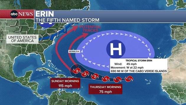
(NEW YORK) --Tropical Storm Erin is forecast to strengthen into the first hurricane of the Atlantic season by Saturday morning and then become a major Category 3 hurricane by Sunday morning as it passes north of Puerto Rico.
But as of now, Erin is not expected to pose a direct threat to the U.S.
Puerto Rico can expect 1 or 2 inches of rain from Erin’s outer bands, as well as dangerously rough surf and a high risk of rip currents this weekend and into early next week.
After moving north of Puerto Rico, Erin is forecast to turn north.
The vast majority of meteorological modeling has Erin remaining over the ocean between Bermuda and the East Coast, passing by Bermuda around Wednesday.
While a landfall in the U.S. isn’t expected, there is a chance Erin could bring a few light rain showers to parts of the East Coast. And for those heading to the beach on the East Coast, Erin will bring a high risk of rip currents from Aug. 21 to Aug. 27.
Because Erin is still many days away, meteorologists in Bermuda and the U.S. East Coast will be watching the storm closely, as any deviation east or west could lead to significant impacts.
The National Hurricane Center predicted an above-normal hurricane season for the Atlantic.
August, September and October are the most active months of the Atlantic hurricane season, which ends on Nov. 30.
Copyright © 2025, ABC Audio. All rights reserved.