NWS Confirms More Tornadoes After Last Week's Storms
May 21, 2025


Jessica Mathews / news@whmi.com
A total of 11 tornadoes touched down during last week’s severe storms – including one locally.
The National Weather Service continues to confirm twisters after storms moved through late last Thursday night and early Friday morning.
The worst damage and power outages were in the West Michigan area. No injuries were reported.
The NWS most recently confirmed an EF-1 tornado in Barry County by Gun Lake and an EF-0 tornado in Zeeland Township in Ottawa County. Others were earlier confirmed in Eaton, Calhoun, Saginaw, Genesee, Allegan, and Ionia Counties. A State of Emergency has been declared in Allegan and Kalamazoo Counties.
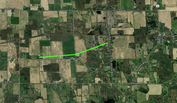
Locally, an EF-1 tornado touched down around 12:03am roughly halfway between Stockbridge and Gregory, just north of M-106 – causing extensive damage to a local farm.
The National Weather Service said initial damage along M-106 was confined to trees with large limbs snapped and a couple uprooted. Structural damage occurred near the M-106 and Dutton Road intersection with a shed suffering roof damage. The Tornado continued northeast and caused significant roof damage to 3 of the 4 barns at Hickory Ridge Dairy Farm. Tree lines just north of those barns also suffered damage with snapped limbs. The tornado tracked east-northeast snapping hardwood trees in the woods east of the farm. The NWS said damage ended near Van Syckle Road, south of the Lakeland Trail but winds gusted out beyond that point with a downburst south of Gregory causing widespread tree damage up to Unadilla Road. Peak wind speeds during that phase were estimated at 70-75mph.
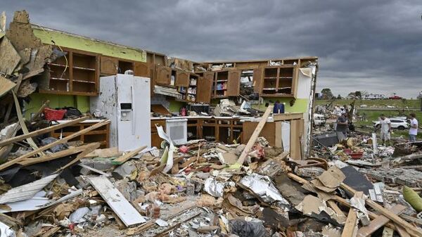
Meanwhile, severe weather and deadly tornadoes continue to pummel the Central United States. More tornadoes plowed through Monday - ripping apart buildings and knocking out power as people from Texas to Kentucky continued to clean up from days of severe weather that killed more than two dozen people and destroyed thousands of homes and buildings. At least four tornadoes were confirmed in Oklahoma and Nebraska on Monday evening, according to a preliminary report from the National Weather Service.
Top Photo: National Weather Service - Gregory Tornado Track
Middle & Bottom: Associated Press - London, Kentucky.

